(Mobile users: Click box above logo for blog pages)


Follow Me

Thursday, April 30, 2020

Route Focus: PVTA Route 45 - Belchertown Center/UMass


Trip: Belchertown Center via Gatehouse Road
Taken: February 2020
As you may already know, most of UMass Transit’s routes are aimed at serving the students of UMass and the rest of the Five Colleges, but there are two “outreach routes” that connect distant towns to the rest of the system. Route 45 to Belchertown is the first of them.

I took the 45 on a winter afternoon, right after UMass’ class time ended. Pulling up to the stop outside 
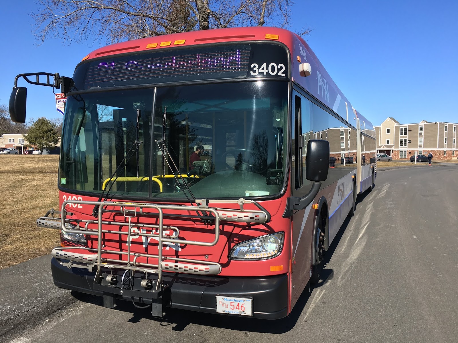
of the Physical Sciences Building, the vehicle operating the trip was PVTA bus #3204, a 2006 Gillig Low Floor 40’.

PVTA bus #3204 on Route 45 at UMass
The ole Gillig pulling up to the PSB

First, we went through the UMass Campus on North Pleasant Street, serving two other stops outside the Integrative Learning Center and the Fine Arts Center. Even though the street was busy with students, only a couple of people boarded at these stops. This would be unusual for any other route at this time of day.

UMass Design Building and SAB
The Design Building and the Studio Arts Building on campus

After the Fine Arts Center stop, the bus turned at an intersection, and still on North Pleasant Street, we left the UMass campus and headed towards Amherst Center.

Amherst Roundabout
Around the roundabout and into downtown
After going around a roundabout and passing a park, we went through Amherst’s Downtown, stopping at Pray Street and Cowles Lane to pick up passengers. Most of the people on this trip got on in Downtown Amherst, rather than UMass.

Main Street, Amherst, USA
Looking down Main Street, Amherst just before turning onto it
The bus turned onto Amherst’s Main Street, and the surroundings of Downtown Amherst were gradually replaced with residential, inns, and the occasional business. After the intersection with East Street, Main Street became Pelham Road, and scenery became even more rural, with more spread apart houses and more tree cover.

Hiking trail in Amherst from the 45
The entrance to a forested hiking spot off of Pelham Road
Soon, the bus turned onto Heatherstone Road, which is a much narrower residential street. Complete with cul-de-sac side streets, you might not expect a fixed bus route to run through this area.

Cul-de-sac woods from the 45
“Out in the sticks”
Soon, the bus turned onto Stony Hill Road, then Gatehouse Road, and the residential became apartment-like, belonging to the Echo Hill and Rolling Green apartment neighborhood.

Gatehouse Road apartments from the 45
Apartments off of Gatehouse Road
After the apartments, we exited onto the main road, Belchertown Road, and continued south. At this point, the scenery was completely rural with houses almost only on side streets.

Before long, we entered Belchertown proper, and the bus turned off of the main road to serve stops on the residential Old Amherst Road. Getting back onto the main road, it was now Federal Street.

Turning onto Old Amherst Road, the building shown is a large church
For the next couple miles, the bus got up to the speed limit of 45 mph, and there were limited stops on the winding and sparsely populated road. This changed after an intersection with Bay Road, and before long we reached the commercial part of Belchertown, which has restaurants, a small shopping plaza, and a whole Stop & Shop.

 This is the best picture I got of any of the businesses around here :(
At the intersection with all these shops, we turned onto Belchertown’s Main Street, making the last leg of the route into Belchertown Center. Eventually we turned off Main Street and onto Park Street, which parallels the town common. At the end of the short Park Street, the bus ended its trip had its layover outside some shops and a small parking lot.

PVTA bus #3204 laying over at Belchertown Center
Laying over at Belchertown Center (spot the error on the destination sign)
Overview
Route 45 makes 7 roundtrips a day, on weekdays only. The bus operates at less than hourly intervals (at best a 70-minute gap), and unfortunately there are some massive service gaps throughout the day. For example, there’s nearly a 5-hour gap in service in the morning. Ridership wise, the 45 performs well for less hourly route with up to 29 passengers per revenue hour during academic months. This number dips to around 12 during the summer but that’s still good for what it is. Route wise, the 45 offers more of a quieter ride and rural feel than most of the other route in UMass Transit’s collection.

Considering all this, the 45 is a pretty decent rural route serving the town Belchertown. The worst feature about the route is its service gaps, and I feel like this route could do better with a consistent schedule of 70- or 80-minute intervals throughout the day. But still, the ridership shows that there’s plenty of people who make do with the limited schedule.

Anyways, the 45 is at least a thousand times better than its alter ego, Route 46, but I’ll save that for another Route Focus.
PVTA bus #3204 heading back to the GAR
On the return trip, the bus heads back to the GAR (garage) after serving UMass stops


Saturday, April 25, 2020

Route Focus: PVTA Route 31 - Sunderland/South Amherst


Trip: Sunderland
Taken: February 2020
At first glance, you might not expect the college town of Amherst to have any impressive bus routes with city-like features like high ridership and frequent buses. Well you’d be wrong; UMass Transit’s routes 30 and 31 have exactly those features when operating during the academic year.

Both routes 30 and 31 travel from north to south through Amherst, serving the UMass Campus in the middle. The southern end of the 31 begins at an off-campus apartment neighborhood called Southpoint Townhouses and The Boulders. The 31 uses an articulated bus (New Flyer XDE60) during semesters, so of course I had to catch a trip with one.


PVTA bus #3402 on Route 31
PVTA #3402, the stretch limo
Leaving the stop for The Boulders on Brittany Manor Drive, we went around the road lined with apartments, and the bus made one more stop before turning onto East Hadley Road. The road curved and paralleled a small brook up until an intersection with South Pleasant Street.

We turned up Pleasant Street heading towards Amherst Center, passing homes with large yards and the generally rural landscape of Amherst with forests and fields. Before long, the buildings and halls of Amherst College appeared, but the 31 doesn’t turn in to serve it, unlike the 38.

Amherst College from Route 31
Buildings of Amherst College
Instead, we made a stop at the busy Amherst Common, then proceeded through the equally active downtown of Amherst with all its cafes and shops.

This is neither a café nor shop, but there are plenty around here
After two more stops for the Amherst Post Office and Pray Street, the bus went around a roundabout and we were now on North Pleasant Street, heading towards the UMass Campus.

Route 31 around the roundabout
Around we go!
Soon, the bus made another turn, starting the stretch of North Pleasant Street running through UMass, which I like to call UMass’ Main Street because of how busy it is.

Fine Arts Center from Route 31
Fine Arts Center and the Haigis Mall
Making three stops along North Pleasant Street (Studio Arts Building, Morrill Science Center, and Arnold House respectively), we made our way along the street gaining more passengers. Usually the bus would be packed by the time we reached the last stop, but the trip I took was during a class-time, and there was only a moderate number of students on the bus continuing north.

UMass Center from Route 31
The view of the campus center and library from North Pleasant St
Going around another roundabout and still on North Pleasant Street, the UMass Campus buildings started to disappear were replaced by residential. We made a stop outside of the Crestview Apartments, which is across the street from UMass’ family-style North Village apartments and close to the Puffton Village Apartments. As you can see, there’s plenty of affiliated and non-unaffiliated off-campus apartments around here.

Puffton Village Apartments from Route 31
Route 30 pulls into and ends at the Puffton Village Apartments
Soon after all the apartments, the bus headed into North Amherst center, which has a couple of businesses and a church, and we turned onto Meadow Street.

Route 31 turning on Meadow Street
Taking tight turns like a champ!
On this street, there’s a stop for more off-campus housing called “Townehouse Apartments” [sic].

Townehouse Apartments from Route 31
Townehouse Apartments. No, I am not misspelling their name.
After this, the bus turned onto the higher speed and almost highway-like Amherst Road. Along here there are only a couple stops at occasional clusters of businesses. Also along Amherst Road, we entered the town of Sunderland.

Stuff off of Amherst Road
Solar Panels by an elementary school, with Mount Sugarloaf in view.
Eventually, we reached Sunderland Center, and we turned down Main Street, making the last leg of the route to Sugarloaf Estates.

Sunderland Center from Route 31
Sunderland Center
Upon reaching Sugarloaf Estates, we turned into the entrance for the apartments and the trip ended at a stop towards the end of the parking lot. FRTA Route 23 to Greenfield also serves Sugarloaf Estates 6 times a day.

PVTA bus #3402 on Route 31 at Sugarloaf Estates
Up close and personal with #3402
Overview
On academic weekdays, the 31 has frequent headways of 15 minutes, and on Thursday, Friday, and Saturday nights, the 31 operates as late as 1 AM to serve the late-night party crowds. For ridership, the 31 has tremendous ridership with up to an average of 40 passengers per trip (or up to 70 passengers per revenue hour). From a transit planner’s perspective, these are great numbers for a mid-sized route like the 31, but from a rider’s perspective, this means packed and often overloaded buses, especially if you didn’t catch the one 60-foot articulated bus and got a 40-foot bus instead.

Packed Route 31
The bus got packed right after I got off. Class time had just ended, and rush-hour was in full swing.
The other downside of the 31 is that it has very long headways of 75 minutes on weekends. This is because the 31 uses just one vehicle on weekends, which is typically an articulated bus. The demand for better headways is certainly there, but the ability for UMass Transit to operate more vehicles on weekends is limited.

The typical loud and crowded experience of riding 31 aside, the 31 is an excellent route with great headways, straightforward routing, and good service on weekdays. Like Route 30, the main purpose of the 31 is to transport students to and from the UMass campus and a variety of off-campus apartments in Amherst and Sunderland. While the 31’s purpose is quite specific, the service is on par with trunk routes connecting dense areas, like the B7 or G1 in Springfield. Plus, it’s just cool and unique to see articulated buses running on rural roads.

Thursday, April 23, 2020

Route Focus: PVTA G2E - East Springfield Express


Trip: East Springfield via Cottage Street / I-291 Express
Taken: June 2019
Usually, I’m cool with the PVTA’s express routes, and when I first heard that they’d be making an express version of my home route, the G2, I was pretty stoked. When I found out the details though, and the fact that they were reducing service on the G2 to make the G2E, I began to extremely dislike this route.

PVTA bus #1635 on the G2E
The G2E at Union Station – Even the destination sign is slighly confusing
I took the G2E on a bright afternoon from Springfield Union Station to the Memorial Industrial Park in East Springfield. The vehicle operating this trip was PVTA bus #1635, a 2007 Gillig Low Floor 40’. Leaving Union Station from the same berth as the G2, we went up Liberty Street, passing the various office buildings and parking garages just outside of Downtown Springfield.

Office buildings outside of Downtown Springfield
An office building near Union Station
The bus turned onto Chestnut Street, and then very shortly turned onto the highway ramp for the I-291 heading east, beginning the express portion of the route.

I-291 from the G2E
The view just after getting on I-291
Getting up to highway speed, the bus roared down I-291, aka the “Springfield Expressway”, for about 3½ miles, heading toward the industrial East Springfield.

PVTA bus #1635 interior
The interior of #1635
Taking exit #5A, we were now on Page Boulevard. This is now the non-express portion, which regular G2 “Cottage Street” trips take. Going up Page Boulevard, there’s initially some industrial warehouses, but the surroundings became residential as the road curves.

Park on Page Boulevard
There is a small park though
After a bit, the bus turned onto Brookdale Drive, and there’s just various industrial buildings again, along with some offices.

Turning onto Brookdale Drive
At the end of Brookdale Drive, the bus turned onto Cottage Street and we stopped across the street from the new Springfield-area bus operations and maintenance center for PVTA. See, the G2E was created to coincide with the opening of the new facility. The purpose of this is that drivers switch out of buses at certain times of the day, and the G2E provides a fast way for PVTA drivers and staff to get between Union Station and the facility. Sure enough, there was 1 PVTA worker who was on the bus and got off here, but earlier on the same day when I rode the G2E, there was at least 7 PVTA workers getting off at the stop.

PVTA Cottage Street facility
The front of the beautiful and huge facility
Anyways, the bus continued on Cottage Street, passing all sorts of businesses, including a day care center and an animal adoption center.

Businesses on Cottage Street
Businesses like this
After a bit, the bus turned onto Industry Avenue, stopping at the Department of Transitional Assistance (DTA). This stop was another reason the PVTA used for the creation of the G2E. The DTA used to be in a building right next to Union Station, but it was moved to Cottage Street in the same year. There was even a petition on change.org with more than 100 signatures demanding the PVTA or the city or the center itself to provide shuttle buses to the DTA.

Department of Transitional Assistance from the G2E
The building of the DTA also houses other government offices
Continuing on Industry Avenue, we passed some more official offices, then we turned onto Memorial Drive, ending at the same stop as the G2 and X92.

PVTA bus #1635 on the G2E
The only thing that’s true about both the G2E and the AD on the bus is that ¡Es rĂ¡pido!
Overview
The G2E operates at a messy 50-minute interval on weekdays only. What really sucks about the G2E is that the hours it operates are very limited, with the first trip leaving at 9:40 AM and last trip at 5:35 PM. The G2E barely meets the ridership threshold for hourly routes, with around 7 passengers per revenue hours. The trip I was on got exactly 7 people.

The fact that the creation of the G2E reduced the service of a the high-ridership G2 from every 20 minutes to every 30 minutes (Saturday service levels) is a big slap in the face to all the other riders of the G2 who have no purpose of going to the industrial park. This area isn’t even a big ridership magnet anyway. Also, since the G2E doesn’t start operating until late in the morning, so its useless for getting people to work in the morning.

In my opinion, the G2E is the most useless route the PVTA currently operates. I'd be happy seeing it go away and 20-minute service restored to the regular G2, which serves the same destinations as the G2E anyway.

Wednesday, April 22, 2020

Route Focus: PVTA X92 - Mid-City Crosstown


Trip: Memorial Industrial Park via Senior Center and Roosevelt
Taken: June 2019
Welcome to the X92, the second of the PVTA “X” crosstown routes. Unlike the lengthier and straighter X90, the X92 has more of a crescent shaped routing from Downtown Springfield to East Springfield via the South End.

PVTA bus #1554 on the X92 at Springfield Union Station
A lovely day for a bus ride
I took the X92 on a spring afternoon. The vehicle operating the trip was PVTA bus #1554, a 2008 Gillig Low Floor 35’. Leaving Union Station, we headed towards Downtown Springfield on Main Street. Encountering a bit of afternoon traffic, we slowly made our way through Downtown, passing the towers, Court Square, the MassMutual Center, MGM Springfield, etc, etc.

State Street from the X92
State Street – We’ll meet up with State Street later on
Further down Main Street, we left the more built up downtown and entered Springfield’s South End, where dense businesses, shops, and residential buildings remained.

Brick apartments off of Main Street
Lovely brick apartments off of Main Street
The road curved and we were now on Locust Street. Up to this point, the X92 followed the same routing as the G1 and G2 from Union Station, but that changed once we turned onto Mill Street. On this street, there were no longer shops, but just apartments of varying densities.

Residential on Mill Street
Apartments, except for this historic single-family home
Mill Street curves a bit and the X92 joins up and shares a couple of stops with the G5. Passing the Johnny Appleseed Park, Mill Street gains a grass median, along with mixed shops on one side of the street. Mill Street ends here and splits off into Dickinson Street and Orange Street, and the X92 takes Orange Street.

Shops on Orange Street
These shops sure do add a splash of color
On Orange Street, there are more dense two-family homes, and shops at major intersections like Oakland Street and White Street (the latter is served by the X90).

Corner stores at Orange and White Streets
Corner stores at the intersection of White and Orange
Soon, Orange Street ends, and we were briefly on Allen Street before turning onto Island Pond Road. Around the start of Island Pond Road, there’s two shopping plazas with a variety of retail including Rocky’s Hardware, a Rite-Aid Pharmacy, and Nathan Bill’s Bar & Restaurant.

Shopping Plaza on Island Pond Road
Just a shopping plaza
After the shopping plazas though, the retail ends and there’s mostly one-story homes. Further down Island Pond Road, there are two churches and the road ends and splits off into Roosevelt Avenue.

Intersection of Island Pond Road and Roosevelt
This intersection was recently redone with bike lanes and greenspace. Love it!
The bus took a left onto Roosevelt and we proceeded to cross a bridge over the Watershops Pond. Continuing on Roosevelt, there’s more single-family homes and a wooded park on the other side of the street.

Intersection of Roosevelt Avenue and Alden Street
The intersection of Alden Street, just after Watershops Pond
Roosevelt Avenue curves at the intersection of Wilbraham Road (B17), and after a brief stretch, we turned off of Roosevelt Avenue and onto Berlin Street, going up a hill to meet up with State Street.

We turned off of the side-street and began our short run on the wide and busy State Street, shared by the B7 and B7s. Here, there are stops serving the MassMutual headquarters, the Science & Technology High School, and Putnam High School.

Putnam High School from the X92
Putnam has the best landscape design and building out of any high school in Springfield
After that, we turned onto the narrow Blunt Park Road, which parallels Putnam High and a hospital, and we had to make a deviation to serve the Independence House apartment building, also served by some trips of the B7.

Independence House from the X92
Independence House
Leaving Independence House and back on Blunt Park Road, we crossed Roosevelt Avenue and entered the forested rear entrance of Blunt Park, passing a swimming pool, and we turned to serve the entrance of the Raymond Jordan Senior Center, a relatively new building hidden away in the trees.

Raymond Jordan Senior Center from the X92
Literally hidden in the trees
We looped back around parking lot and back to the entrance of Blunt Park, this time turning onto Roosevelt Avenue.

Roosevelt Avenue curves and there’s mostly forest on each side of the street until Central High emerges, along with an ice rink, and the main entrance of Blunt Park.

Central High School from the X92
Central High School
Going by an intersection with Bay Street (B6), we crossed a bridge over some railroad tracks and entered the industrial section of Roosevelt Avenue. We passed by several industrial buildings, as well as some medical offices, the massive Smith & Wesson factory, and the headquarters of Big Y.

Smith & Wesson from the X92
The entrance to Smith & Wesson
The bus turned onto Cottage Street, then Industry Avenue, passing the transitional assistance center and other official offices, and we finally turned onto Memorial Drive. The route ends on Memorial Drive outside of a large parking lot and the operations center for Columbia Gas. The X92 shares the last stop with the northern branch of the G2 and G2E.

X92 End on Memorial Drive
I had to rush to catch the next bus so this was the best shot I could get at the end. The bus at the back is the X92.
Overview
The X92 was created back in 2015, making it a recent route, but in its short existence, its weekday service was reduced to have headways of 60 minutes instead of every 45 minutes. For some reason, Saturday service was maintained at 45-minute levels and it still is, making the X92 the only PVTA route with better service on Saturdays. For ridership, the X92 gets around 20 passengers per revenue hour, or about 10 passengers per trip. The trip I was on got 15 passengers overall. From my experience, the X92 is busiest when students use it to get to and from the 3 high schools the route serves in the morning and afternoon. During all other times, the X92 is emptier. As for the routing itself, I don’t to consider the X92 a true “crosstown” route, but more of a radial route instead.

It’s hard for me to like the X92. Sure, it’s useful if you live on or near Orange, Island Pond, or Roosevelt and want to get to Downtown, the High Schools, or the Industrial Park, but if you just want to get from Downtown to those destinations, taking the most direct route like the G1, G2, B6, or B7 is faster. The X92 doesn’t run very late, with the last trips leaving at 6PM, and in my opinion, no route that travels through dense areas as this should have headways of 60 minutes. Perhaps the PVTA will restore service when times are better and there’s more money for service improvements. For now, the X92 remains the lesser of the PVTA’s crosstown routes and routes serving Springfield in general.